| Sno |
Parameters |
Information |
| 1. |
Name of Panchayat(Block & District) |
Paharthan, Waterhail, BUDGAM
|
| 2. |
Number of Villages |
2
|
| 3. |
Name of Villages |
PAHARTHAN AND LASIPORA
|
| 4. |
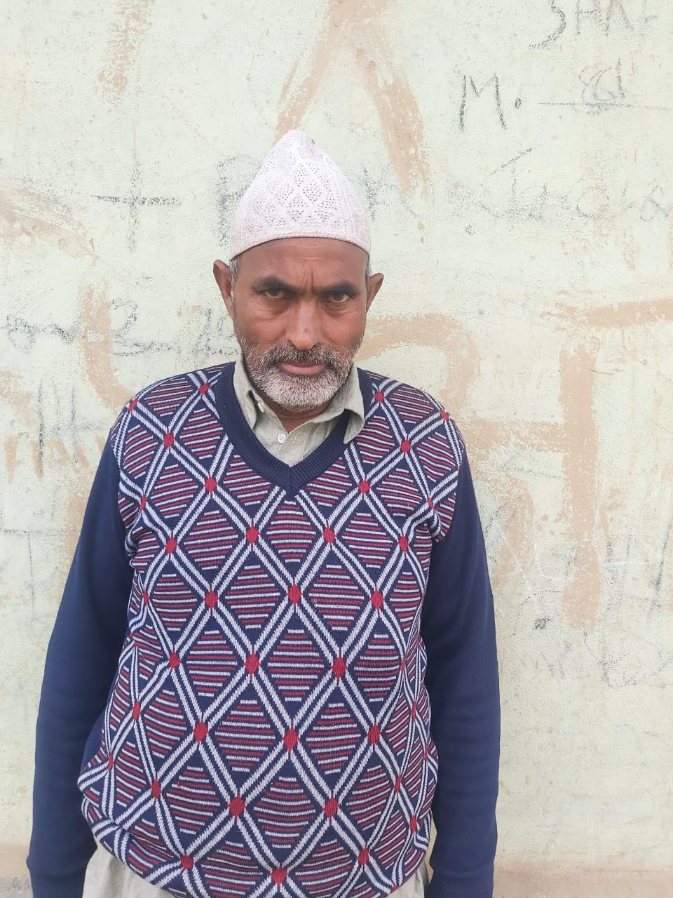
Sarpanch Name and Photograph |
GH NABI DAR
|
| 5. |
Sarpanch Mobile No |
9541613245
|
| 6. |
Panchs Name |
Ab rahman Dar,
Rehana Bano,
Ishaq Ah Bhat,
Farooq Ah Bhat,
Tasleema Begum,
showkat Ah Dar,
Mohd shafi Dar,
Taja Begum,
Ab Rashid Tantray,
|
| 7. |
List of govt. officials |
MUDASIR AHMAD WANI,
SHOWKAT HUSSAIN PARA,
FIRDOUS AHMAD BHAT,
|
| 8. |
Latitude/ Longitude |
33.65, 74.24
|
| 9. |
Area |
194 HECTARES
|
| 10. |
Male (Population) |
820
|
| 11. |
Female (Population) |
835
|
| 12. |
Literacy rate |
52%
|
| 13. |
Map |
|
| 14. |
Topography |
Hilly
|
| 15. |
Major Water source of Irrigation |
canal
|
| 16. |
Water related govt. Schemes |
N/A
|
| 17. |
Crops |
Rice, Maize, Wheat, Apple, Walnut, almonds etc.
|
| 18. |
Schools |
PRIAMARY AND HIGH SCHOOL
|
| 19. |
Angandwadi centers |
4
|
| 20. |
Status of Electrification |
Fully electrified
|
| 21. |
Status of piped water |
Functional
|
| 22. |
Name of Police station |
PLOICE STATION BUDGAM
|
| 23. |
Health Institutions |
PRIMARY HEALTH CENTRE
|
| 24. |
Animal Husbandry |
NO
|
| 25. |
Livestock�s |
450
|
| 26. |
No. of Self Help Groups |
02
|
| 27. |
Altitude above Sea Level |
1690M
|
| 28. |
Veterinary |
No
|
| 29. |
Specialty Crops etc. Natural Crops
|
WALNUTS
|
| 30. |
Roads Connectivity |
yes
|
| 31. |
Prominent Tourist/ Religion places in the Panchyat |
N/A
|
| 32. |
Distance from Nearest Headquater |
18KM
|
| 33. |
PMAY Houses Approved |
0
|
| 34. |
PMAY Houses Completed |
0
|
| 35. |
No of House Holds |
244
|
| 36. |
No of House holds with toilets |
244
|
| 37. |
Does the Panchayat has its own Panchayat ghar |
Yes
|
| 38. |
Rented/Owned |
Owned
|
| 39. |
Geotagged Photo of Panchayat |
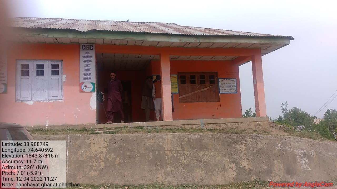
|
| 40. |
Geotagged Photo of Panchayat2 |

|
| 41. |
Uploaded Map |
|
