| Sno |
Parameters |
Information |
| 1. |
Name of Panchayat(Block & District) |
Bhadurkote, Teetwal, KUPWARA
|
| 2. |
Number of Villages |
2
|
| 3. |
Name of Villages |
Bhadurkote,Pingla haridal
|
| 4. |
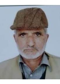
Sarpanch Name and Photograph |
Nisar Ahmed Mir
|
| 5. |
Sarpanch Mobile No |
9797262841
|
| 6. |
Panchs Name |
Abdul Khalid,
Shakoor ahmed,
Sakeena Begum,
Farooq Hussain,
Waqar Hussain ,
Mehmooda Fatima,
Tariq Ahmed,
Nisahad Begum,
Mumtaz Ali Khan,
|
| 7. |
List of govt. officials |
Hakim Aqeb,
Nisar ahmed Mir,
Zameer Hussain Shah,
Amraiz Ahmed,
|
| 8. |
Latitude/ Longitude |
34.377105, 73.789738
|
| 9. |
Area |
5.3663 Sq Km
|
| 10. |
Male (Population) |
757
|
| 11. |
Female (Population) |
667
|
| 12. |
Literacy rate |
65%
|
| 13. |
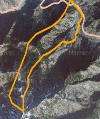
Map |
|
| 14. |
Topography |
Hilly
|
| 15. |
Major Water source of Irrigation |
Rain Fed
|
| 16. |
Water related govt. Schemes |
........
|
| 17. |
Crops |
Wheat,Paddy,Maze,Vegitables,oat
|
| 18. |
Schools |
High School,Middle School,Pry School
|
| 19. |
Angandwadi centers |
9
|
| 20. |
Status of Electrification |
99%
|
| 21. |
Status of piped water |
98%
|
| 22. |
Name of Police station |
Tangdar
|
| 23. |
Health Institutions |
sub health center
|
| 24. |
Animal Husbandry |
0
|
| 25. |
Livestock�s |
...
|
| 26. |
No. of Self Help Groups |
0
|
| 27. |
Altitude above Sea Level |
....
|
| 28. |
Veterinary |
0
|
| 29. |
Specialty Crops etc. Natural Crops
|
......
|
| 30. |
Roads Connectivity |
yes
|
| 31. |
Prominent Tourist/ Religion places in the Panchyat |
Forest tourism
|
| 32. |
Distance from Nearest Headquater |
90 km
|
| 33. |
PMAY Houses Approved |
|
| 34. |
PMAY Houses Completed |
|
| 35. |
No of House Holds |
|
| 36. |
No of House holds with toilets |
|
| 37. |
Does the Panchayat has its own Panchayat ghar |
|
| 38. |
Rented/Owned |
|
| 39. |
Geotagged Photo of Panchayat |

|
| 40. |
Geotagged Photo of Panchayat2 |
|
| 41. |
Uploaded Map |
|
