| Sno |
Parameters |
Information |
| 1. |
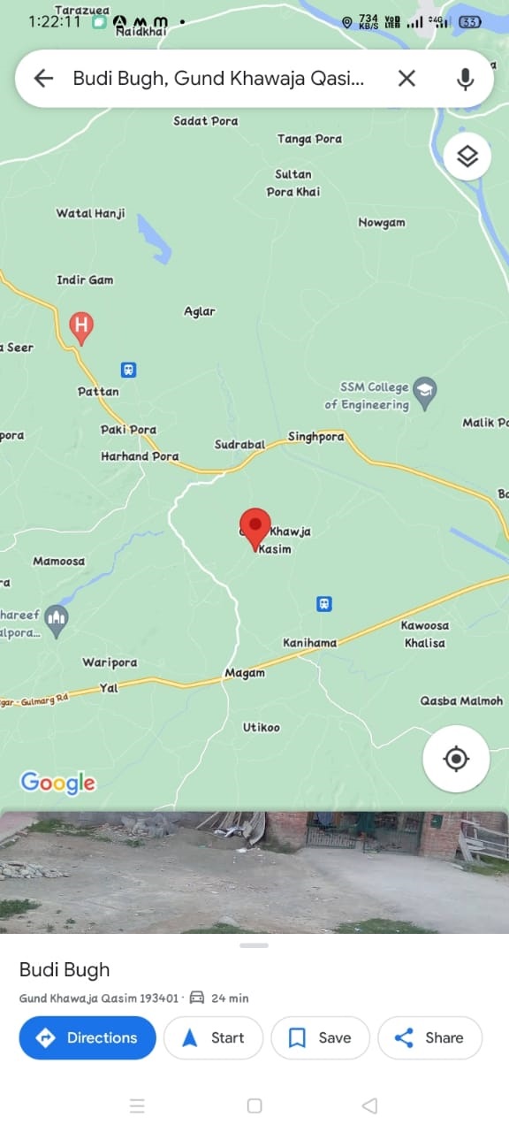
Name of Panchayat(Block & District) |
Budibugh, Sherabad Khore, Baramulla
|
| 2. |
Number of Villages |
03
|
| 3. |
Name of Villages |
BUDIBUGH, HAGERPORA & SHALBONI
|
| 4. |
Sarpanch Name and Photograph |
Gh hussain dar

|
| 5. |
Sarpanch Mobile No |
9596329139
|
| 6. |
Panchs Name |
GH HASSAN MALLA,
ASMAT BANOO,
NISAR AH MIR,
AB MAJID MALLA,
TASLEEMA BEGUM,
SHABIR AH DAR,
|
| 7. |
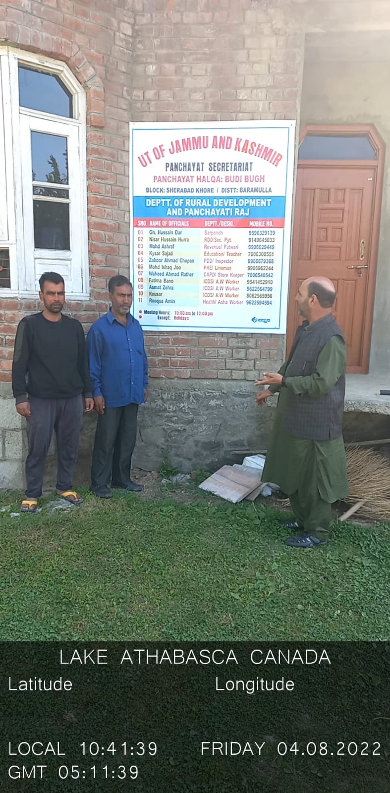
List of govt. officials |
NISAR HUSSAIN HURRA,
MOHD ASHRAF,
ZAHOOR AHMAD CHOPAN,
WAHEED AHMAD RATHER,
KYSAR SAJAD,
MOHD ISHAQ JOO,
FATIMA BANO,
ROOQUA AMIN,
|
| 8. |
Latitude/ Longitude |
34.116366, 74.606919
|
| 9. |
Area |
90 hectares
|
| 10. |
Male (Population) |
1430
|
| 11. |
Female (Population) |
1510
|
| 12. |
Literacy rate |
25%
|
| 13. |
Map |
|
| 14. |
Topography |
plain
|
| 15. |
Major Water source of Irrigation |
Canals
|
| 16. |
Water related govt. Schemes |
no scheme
|
| 17. |
Crops |
rice
|
| 18. |
Schools |
03
|
| 19. |
Angandwadi centers |
05
|
| 20. |
Status of Electrification |
satisfactory
|
| 21. |
Status of piped water |
only30%
|
| 22. |
Name of Police station |
magam
|
| 23. |
Health Institutions |
NILL
|
| 24. |
Animal Husbandry |
0
|
| 25. |
Livestock�s |
150
|
| 26. |
No. of Self Help Groups |
10
|
| 27. |
Altitude above Sea Level |
3235M
|
| 28. |
Veterinary |
0
|
| 29. |
Specialty Crops etc. Natural Crops
|
RICE
|
| 30. |
Roads Connectivity |
satisfactory
|
| 31. |
Prominent Tourist/ Religion places in the Panchyat |
NILL
|
| 32. |
Distance from Nearest Headquater |
40
|
| 33. |
PMAY Houses Approved |
02
|
| 34. |
PMAY Houses Completed |
02
|
| 35. |
No of House Holds |
338
|
| 36. |
No of House holds with toilets |
325
|
| 37. |
Does the Panchayat has its own Panchayat ghar |
Yes
|
| 38. |
Rented/Owned |
Rented
|
| 39. |
Geotagged Photo of Panchayat |
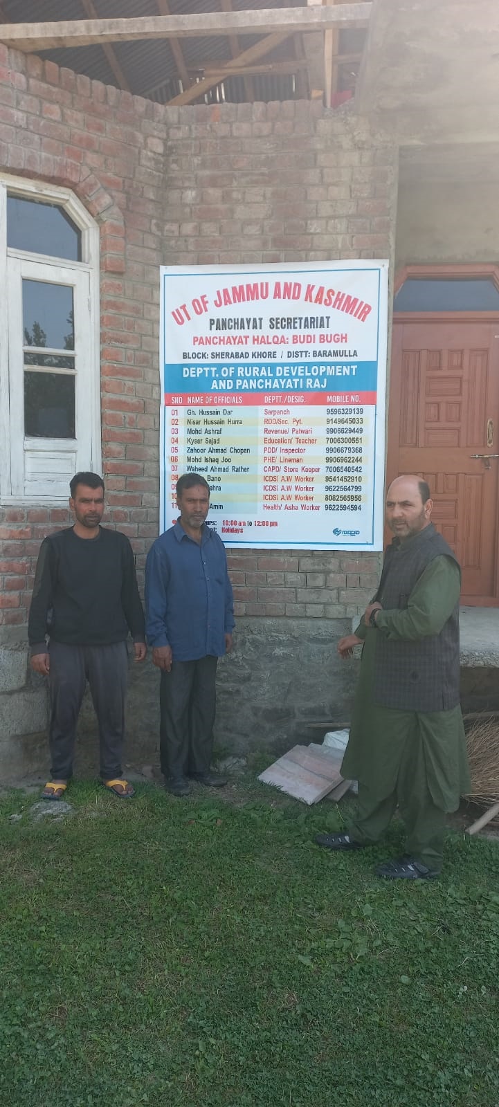
|
| 40. |
Geotagged Photo of Panchayat2 |
|
| 41. |
Uploaded Map |
|
