| Sno |
Parameters |
Information |
| 1. |
Name of Panchayat(Block & District) |
Chak Balotrian, Ramgarh, Samba
|
| 2. |
Number of Villages |
9
|
| 3. |
Name of Villages |
Chak Balotran, Rajpur Jattan, Chak Salaria, Dunne Chak, Hira Chak, Chak Shama, Maharajpur, Dug Balotrian & Kullian
|
| 4. |
Sarpanch Name and Photograph |
Sh. Roop Chand

|
| 5. |
Sarpanch Mobile No |
0
|
| 6. |
Panchs Name |
Kuldeep Kumar,
Asha Rani,
Tilak Raj,
Babu Ram,
Anu,
Darbari Lal,
Sewa Singh,
|
| 7. |
List of govt. officials |
Pawan kumar,
Rakesh Gupta,
Pomila Devi,
|
| 8. |
Latitude/ Longitude |
32.513565, 74.918013
|
| 9. |
Area |
366.4 (in Ha)
|
| 10. |
Male (Population) |
1780
|
| 11. |
Female (Population) |
710
|
| 12. |
Literacy rate |
71.80%
|
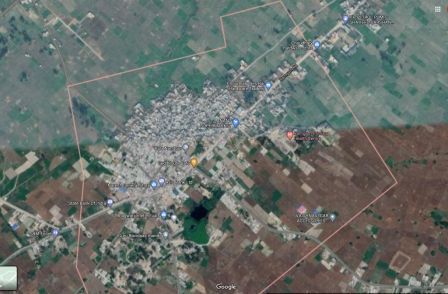
| 13. |
Map |
|
| 14. |
Topography |
Plain
|
| 15. |
Major Water source of Irrigation |
Ground Water(Tube well, well ,pumpset)
|
| 16. |
Water related govt. Schemes |
Jal Shakti
|
| 17. |
Crops |
Rice & Wheat
|
| 18. |
Schools |
3
|
| 19. |
Angandwadi centers |
6
|
| 20. |
Status of Electrification |
8-12 hours
|
| 21. |
Status of piped water |
100% covered but not functional
|
| 22. |
Name of Police station |
Ramgarh
|
| 23. |
Health Institutions |
1
|
| 24. |
Animal Husbandry |
1
|
| 25. |
Livestock�s |
0
|
| 26. |
No. of Self Help Groups |
6
|
| 27. |
Altitude above Sea Level |
320
|
| 28. |
Veterinary |
1
|
| 29. |
Specialty Crops etc. Natural Crops
|
Rice and Wheat
|
| 30. |
Roads Connectivity |
Good
|
| 31. |
Prominent Tourist/ Religion places in the Panchyat |
0
|
| 32. |
Distance from Nearest Headquater |
3.5 KM
|
| 33. |
PMAY Houses Approved |
|
| 34. |
PMAY Houses Completed |
|
| 35. |
No of House Holds |
|
| 36. |
No of House holds with toilets |
|
| 37. |
Does the Panchayat has its own Panchayat ghar |
|
| 38. |
Rented/Owned |
|
| 39. |
Geotagged Photo of Panchayat |

|
| 40. |
Geotagged Photo of Panchayat2 |
|
| 41. |
Uploaded Map |
|
