| Sno |
Parameters |
Information |
| 1. |
Name of Panchayat(Block & District) |
Sultan Daki, Parenpillan, Baramulla
|
| 2. |
Number of Villages |
1
|
| 3. |
Name of Villages |
sultandaki
|
| 4. |
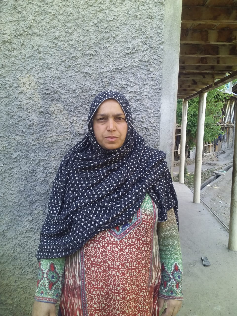
Sarpanch Name and Photograph |
parveen akhter
|
| 5. |
Sarpanch Mobile No |
8899968258
|
| 6. |
Panchs Name |
ab majeed mir,
shazia begum,
amjad ali qureshi,
adil shareef,
muneera begum,
ablal ahmad mir,
sajaad ahmad mir,
hajira begum,
mukhhtar ahmad qureshi,
|
| 7. |
List of govt. officials |
|
| 8. |
Latitude/ Longitude |
34.120748, 73.993386
|
| 9. |
Area |
588.86 Ha
|
| 10. |
Male (Population) |
1525
|
| 11. |
Female (Population) |
1475
|
| 12. |
Literacy rate |
75.00
|
| 13. |
Map |
|
| 14. |
Topography |
hilly
|
| 15. |
Major Water source of Irrigation |
surface water
|
| 16. |
Water related govt. Schemes |
no
|
| 17. |
Crops |
maize,paddy, fodder crops
|
| 18. |
Schools |
1 govt higher secondary, 3 govt middle school , 1 govt primary school, 1 KGPBVY
|
| 19. |
Angandwadi centers |
5
|
| 20. |
Status of Electrification |
100%
|
| 21. |
Status of piped water |
70%
|
| 22. |
Name of Police station |
Uri
|
| 23. |
Health Institutions |
GOVT PRIMARY HEALTH CENTRE
|
| 24. |
Animal Husbandry |
1 ANIMAL HUSBANDARY AND 1 SHEEP HUSBANDARY
|
| 25. |
Livestock�s |
SHEEP, COW, GOAT, POULTARY
|
| 26. |
No. of Self Help Groups |
3
|
| 27. |
Altitude above Sea Level |
1396.64 m
|
| 28. |
Veterinary |
1
|
| 29. |
Specialty Crops etc. Natural Crops
|
NO
|
| 30. |
Roads Connectivity |
All weather single lane
|
| 31. |
Prominent Tourist/ Religion places in the Panchyat |
NO
|
| 32. |
Distance from Nearest Headquater |
54
|
| 33. |
PMAY Houses Approved |
13
|
| 34. |
PMAY Houses Completed |
0
|
| 35. |
No of House Holds |
530
|
| 36. |
No of House holds with toilets |
530
|
| 37. |
Does the Panchayat has its own Panchayat ghar |
No
|
| 38. |
Rented/Owned |
Rented
|
| 39. |
Geotagged Photo of Panchayat |
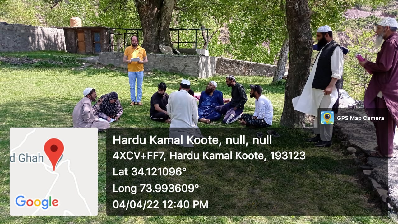
|
| 40. |
Geotagged Photo of Panchayat2 |

|
| 41. |
Uploaded Map |
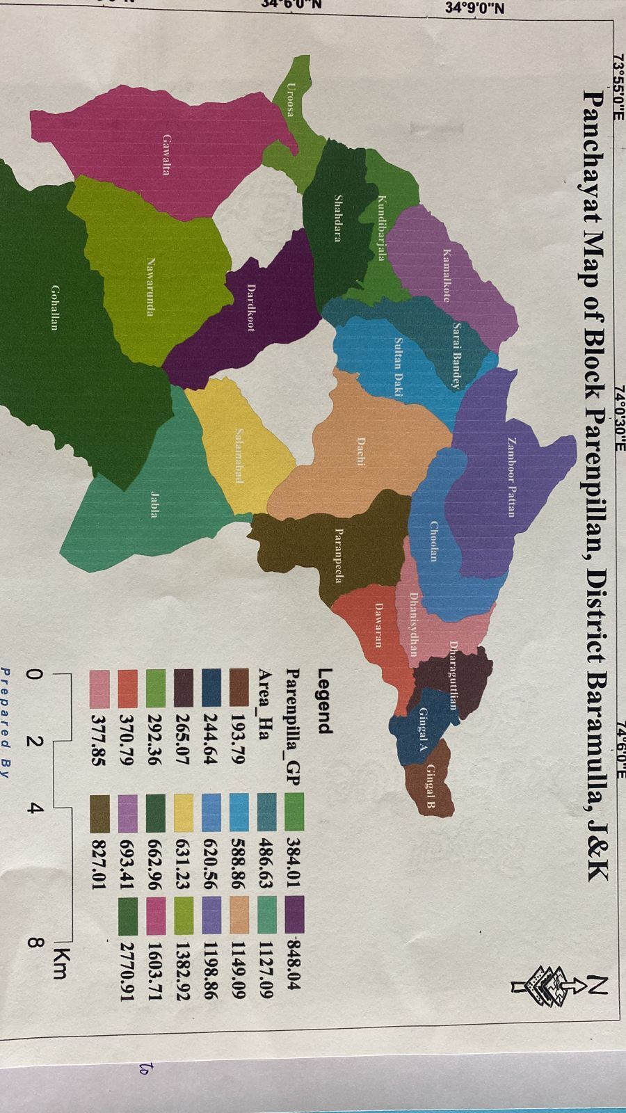
|
