| Sno |
Parameters |
Information |
| 1. |
Name of Panchayat(Block & District) |
Satura, Hiranagar, Kathua
|
| 2. |
Number of Villages |
2
|
| 3. |
Name of Villages |
Satura, Dhamyal
|
| 4. |
Sarpanch Name and Photograph |
Bhagmal Khajuria

|
| 5. |
Sarpanch Mobile No |
9622152700
|
| 6. |
Panchs Name |
Jagdev Singh,
Madhu Bala,
Mukesh Kumar,
Sethi Mehta,
Santosh Kumari,
Vijay Kumar,
Rohit Khajuria,
|
| 7. |
List of govt. officials |
Lukhinder Singh,
Rohit Kumar,
Mohammad Rafiq,
Rajani Devi,
Santosh Kumari,
|
| 8. |
Latitude/ Longitude |
32.5119, 75.2744
|
| 9. |
Area |
314 hectares
|
| 10. |
Male (Population) |
976
|
| 11. |
Female (Population) |
915
|
| 12. |
Literacy rate |
94.03
|
| 13. |
Map |
|
| 14. |
Topography |
Plain
|
| 15. |
Major Water source of Irrigation |
Rainwater
|
| 16. |
Water related govt. Schemes |
yes
|
| 17. |
Crops |
Wheat, Maize , bajra
|
| 18. |
Schools |
Primary, High
|
| 19. |
Angandwadi centers |
5
|
| 20. |
Status of Electrification |
100 percent
|
| 21. |
Status of piped water |
100 percent
|
| 22. |
Name of Police station |
Hiranagar
|
| 23. |
Health Institutions |
Primary Health Centre
|
| 24. |
Animal Husbandry |
Yes
|
| 25. |
Livestock�s |
Cow, buffalo, goats
|
| 26. |
No. of Self Help Groups |
0
|
| 27. |
Altitude above Sea Level |
420
|
| 28. |
Veterinary |
1
|
| 29. |
Specialty Crops etc. Natural Crops
|
Wheat
|
| 30. |
Roads Connectivity |
Yes
|
| 31. |
Prominent Tourist/ Religion places in the Panchyat |
Chiragu Mata Temple at Dhamyal
|
| 32. |
Distance from Nearest Headquater |
48 km
|
| 33. |
PMAY Houses Approved |
8
|
| 34. |
PMAY Houses Completed |
4
|
| 35. |
No of House Holds |
354
|
| 36. |
No of House holds with toilets |
346
|
| 37. |
Does the Panchayat has its own Panchayat ghar |
Yes
|
| 38. |
Rented/Owned |
Owned
|
| 39. |
Geotagged Photo of Panchayat |
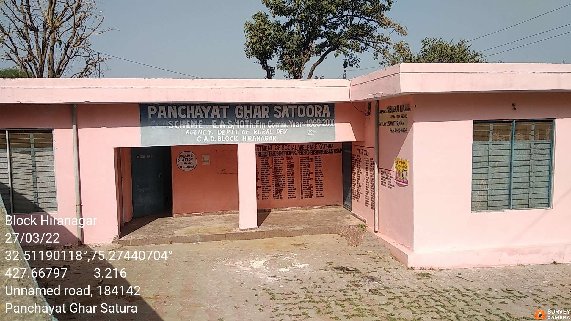
|
| 40. |
Geotagged Photo of Panchayat2 |
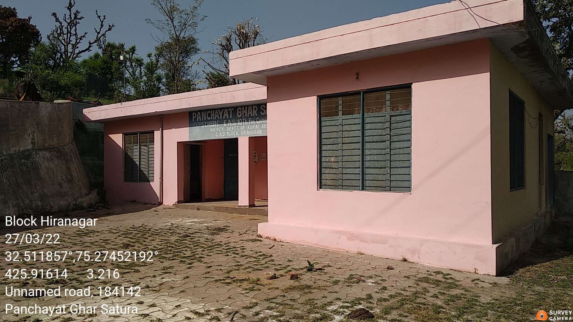
|
| 41. |
Uploaded Map |
|
