| Sno |
Parameters |
Information |
| 1. |
Name of Panchayat(Block & District) |
Lowermunda, Hiller Shahabad, ANANTNAG
|
| 2. |
Number of Villages |
2
|
| 3. |
Name of Villages |
Upper Munda Gujjar Basti, Lower Mundah Gujjar Basti
|
| 4. |
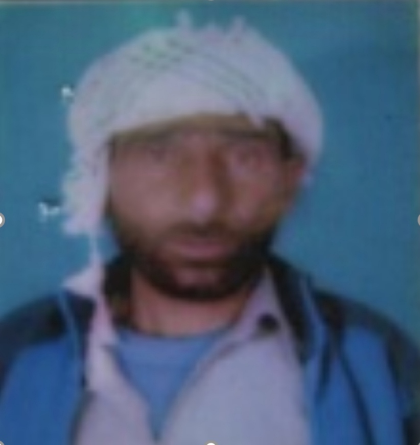
Sarpanch Name and Photograph |
Showkat Ahmad Khatana
|
| 5. |
Sarpanch Mobile No |
9103280452
|
| 6. |
Panchs Name |
Shareefa Banoo,
Gull Mohd Rather,
Ulfat Banoo,
Mohd iqbal rather,
|
| 7. |
List of govt. officials |
Haamid Jalil Bhat,
Mohd Shafi Shah,
|
| 8. |
Latitude/ Longitude |
33.546486, 75.208
|
| 9. |
Area |
NA
|
| 10. |
Male (Population) |
1731
|
| 11. |
Female (Population) |
1592
|
| 12. |
Literacy rate |
52.97
|
| 13. |
Map |
|
| 14. |
Topography |
Hilly terrain
|
| 15. |
Major Water source of Irrigation |
Reshnag Spring, Aardkaji nallah
|
| 16. |
Water related govt. Schemes |
Jal jeevan Mission
|
| 17. |
Crops |
Rice , Maize, Mustard
|
| 18. |
Schools |
Govt. Middle school Lowermunda, Govt Primary School Gujjar Basti
|
| 19. |
Angandwadi centers |
5
|
| 20. |
Status of Electrification |
Fully electrified
|
| 21. |
Status of piped water |
Partly connected with pipe water
|
| 22. |
Name of Police station |
PS Qazigund
|
| 23. |
Health Institutions |
Nil
|
| 24. |
Animal Husbandry |
0
|
| 25. |
Livestock�s |
1
|
| 26. |
No. of Self Help Groups |
2
|
| 27. |
Altitude above Sea Level |
1900m
|
| 28. |
Veterinary |
0
|
| 29. |
Specialty Crops etc. Natural Crops
|
Walnut, Apple
|
| 30. |
Roads Connectivity |
75% population has road connectivity
|
| 31. |
Prominent Tourist/ Religion places in the Panchyat |
Ziyarat e Sharif Reshwani and Peer Baba
|
| 32. |
Distance from Nearest Headquater |
30
|
| 33. |
PMAY Houses Approved |
15
|
| 34. |
PMAY Houses Completed |
0
|
| 35. |
No of House Holds |
421
|
| 36. |
No of House holds with toilets |
380
|
| 37. |
Does the Panchayat has its own Panchayat ghar |
Yes
|
| 38. |
Rented/Owned |
Rented
|
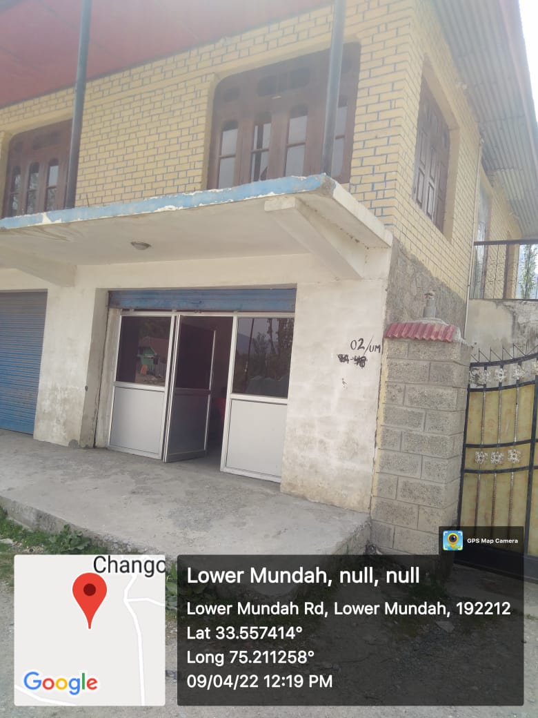
| 39. |
Geotagged Photo of Panchayat |
|
| 40. |
Geotagged Photo of Panchayat2 |

|
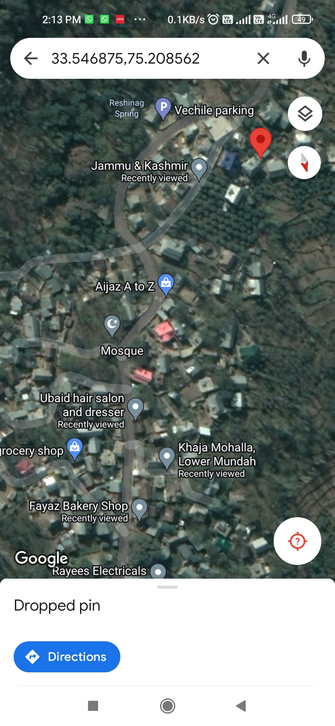
| 41. |
Uploaded Map |
|
