| Sno |
Parameters |
Information |
| 1. |
Name of Panchayat(Block & District) |
Sadorata, Duggain, Kathua
|
| 2. |
Number of Villages |
1
|
| 3. |
Name of Villages |
Sadrota
|
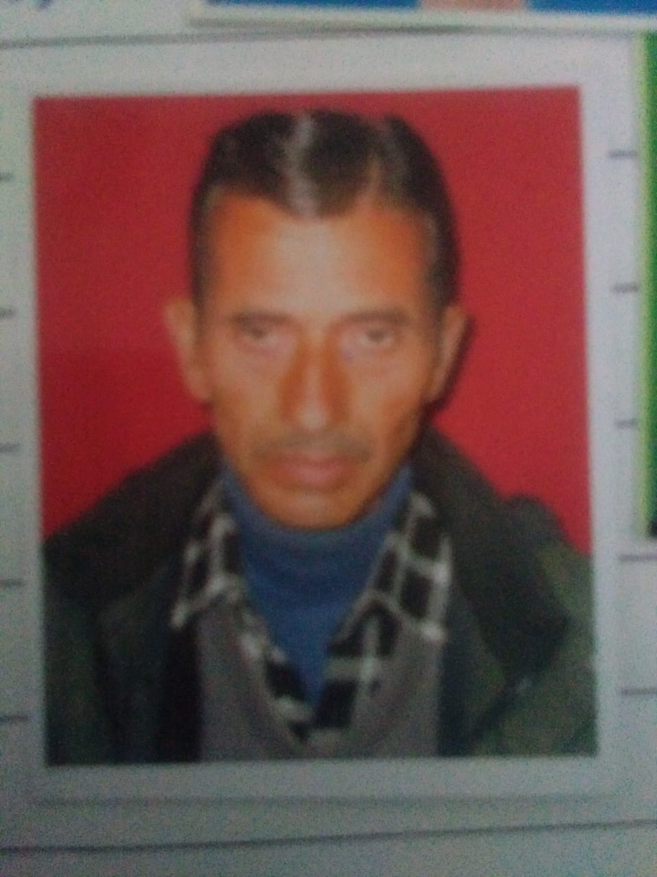
| 4. |
Sarpanch Name and Photograph |
Charan Dass
|
| 5. |
Sarpanch Mobile No |
9858244436
|
| 6. |
Panchs Name |
Shadi Lal,
Des Raj,
Rekha Devi,
Subash Chander,
Krishan Chand,
Rita Devi,
Chaman Lal,
|
| 7. |
List of govt. officials |
Pardeep kumar,
Kishore singh katoch,
|
| 8. |
Latitude/ Longitude |
32.736218, 75.538788
|
| 9. |
Area |
1369 hector
|
| 10. |
Male (Population) |
859
|
| 11. |
Female (Population) |
777
|
| 12. |
Literacy rate |
76%
|
| 13. |
Map |
|
| 14. |
Topography |
hilly terrain
|
| 15. |
Major Water source of Irrigation |
aquafiers
|
| 16. |
Water related govt. Schemes |
PHE
|
| 17. |
Crops |
MAIZE & MUSTARD
|
| 18. |
Schools |
1 Govt higher secondary school
sadrota
2 Govt primary school ravote
3 Govt primary school dhaman
4 Govt primary school garjari
5 Govt primary school kalead
6 Govt primary school kappard
7 Govt middle school junana
|
| 19. |
Angandwadi centers |
Centers at junana, kappard, kappard A, dhaman, sadrota, kalead, dhadi palkri , choura and choundra
|
| 20. |
Status of Electrification |
COMPLETELY ELECTRIFIED
|
| 21. |
Status of piped water |
88%
|
| 22. |
Name of Police station |
Malhar
|
| 23. |
Health Institutions |
Sub Centre
|
| 24. |
Animal Husbandry |
NO
|
| 25. |
Livestock�s |
8250
|
| 26. |
No. of Self Help Groups |
NO
|
| 27. |
Altitude above Sea Level |
1353 mtrs
|
| 28. |
Veterinary |
no
|
| 29. |
Specialty Crops etc. Natural Crops
|
Morel Mushrooms
|
| 30. |
Roads Connectivity |
NO
|
| 31. |
Prominent Tourist/ Religion places in the Panchyat |
Kalaid
|
| 32. |
Distance from Nearest Headquater |
134
|
| 33. |
PMAY Houses Approved |
91
|
| 34. |
PMAY Houses Completed |
22
|
| 35. |
No of House Holds |
256
|
| 36. |
No of House holds with toilets |
256
|
| 37. |
Does the Panchayat has its own Panchayat ghar |
Yes
|
| 38. |
Rented/Owned |
Owned
|
| 39. |
Geotagged Photo of Panchayat |

|
| 40. |
Geotagged Photo of Panchayat2 |
|
| 41. |
Uploaded Map |
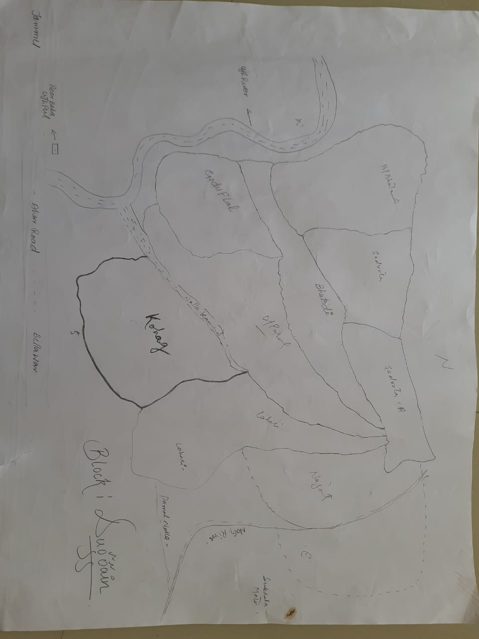
|
