| Sno |
Parameters |
Information |
| 1. |
Name of Panchayat(Block & District) |
GULZARABAD, D K MARG , KULGAM
|
| 2. |
Number of Villages |
2
|
| 3. |
Name of Villages |
Kutamarg Gulzarabad
|
| 4. |
Sarpanch Name and Photograph |
Jamaldin kisana

|
| 5. |
Sarpanch Mobile No |
9906074413
|
| 6. |
Panchs Name |
Nazir Ahmad Badana,
Banoo Alhter,
Raihana ,
Sabzar Ahmad Tantary,
Khadim hussain paswal,
Ghulam Mohammad Dar,
Asadullah Naik,
|
| 7. |
List of govt. officials |
Aijaz Ah ,
Rafiq Ah dar,
Gh Nabi,
Shooby,
Rafiqa,
Aijaz Ahmad,
Idrees sami,
|
| 8. |
Latitude/ Longitude |
33.5501996, 75.0501630
|
| 9. |
Area |
282
|
| 10. |
Male (Population) |
2100
|
| 11. |
Female (Population) |
1800
|
| 12. |
Literacy rate |
87
|
| 13. |
Map |
|
| 14. |
Topography |
Hilly
|
| 15. |
Major Water source of Irrigation |
Canal
|
| 16. |
Water related govt. Schemes |
0
|
| 17. |
Crops |
Maize apple
|
| 18. |
Schools |
Four schools two middle and to primary
|
| 19. |
Angandwadi centers |
6
|
| 20. |
Status of Electrification |
Partly
|
| 21. |
Status of piped water |
Partly
|
| 22. |
Name of Police station |
Ps dkmarg
|
| 23. |
Health Institutions |
Sc Kutamarg sc Gulzarabad
|
| 24. |
Animal Husbandry |
0
|
| 25. |
Livestock�s |
0
|
| 26. |
No. of Self Help Groups |
2
|
| 27. |
Altitude above Sea Level |
2100
|
| 28. |
Veterinary |
0
|
| 29. |
Specialty Crops etc. Natural Crops
|
Maize apple
|
| 30. |
Roads Connectivity |
Yes
|
| 31. |
Prominent Tourist/ Religion places in the Panchyat |
Badi behak
|
| 32. |
Distance from Nearest Headquater |
15
|
| 33. |
PMAY Houses Approved |
20
|
| 34. |
PMAY Houses Completed |
04
|
| 35. |
No of House Holds |
580
|
| 36. |
No of House holds with toilets |
490
|
| 37. |
Does the Panchayat has its own Panchayat ghar |
Yes
|
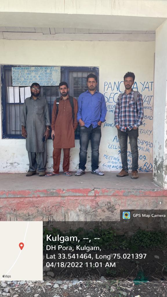
| 38. |
Rented/Owned |
Owned
|
| 39. |
Geotagged Photo of Panchayat |

|
| 40. |
Geotagged Photo of Panchayat2 |
|
| 41. |
Uploaded Map |
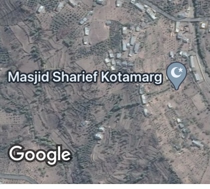
|
