
Panchayat Details
General Profile
| Sno | Parameters | Information |
|---|---|---|
| 1. | Name of Panchayat(Block & District) | Kursari, Bhaderwah, Doda |
| 2. | Number of Villages | 1 |
| 3. | Name of Villages | Kursari |
| 4. | Sarpanch Name and Photograph | Sajid Ali Mir 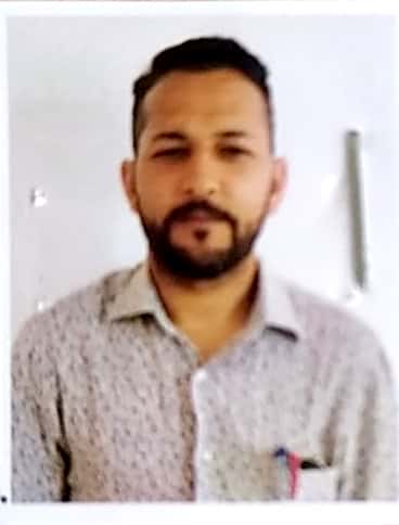
|
| 5. | Sarpanch Mobile No | 7051151521 |
| 6. | Panchs Name | VIJAY KUMAR S/O OM PARKASH, SHANAZA AKHTER W/O NISAR AHMED , KULDEEP SINGH S/O GYAN SINGH, NAZIR AHMED S/O GH. MOUSTAFA MIR, ZAHIDA BANOO W/O MOHD . RAMIZ, KIRAN KUMAR S/O BODH RAJ, FIRDOUS BUTT S/O GH.MOHAMMED BUTT, |
| 7. | List of govt. officials | |
| 8. | Latitude/ Longitude | 33.011734, 75.692624 |
| 9. | Area | 342.6 Hectear |
| 10. | Male (Population) | 1190 |
| 11. | Female (Population) | 1155 |
| 12. | Literacy rate | 80% |
| 13. | Map | |
| 14. | Topography | Hilly |
| 15. | Major Water source of Irrigation | River, Canal, Pond |
| 16. | Water related govt. Schemes | Nil |
| 17. | Crops | Maize, Wheat, Paddy |
| 18. | Schools | Goverment Schools |
| 19. | Angandwadi centers | 4 |
| 20. | Status of Electrification | 100% |
| 21. | Status of piped water | 70% |
| 22. | Name of Police station | PS Bhaderwah |
| 23. | Health Institutions | PHC |
| 24. | Animal Husbandry | Nil |
| 25. | Livestock�s | Cow Sheeps Horses |
| 26. | No. of Self Help Groups | 3 |
| 27. | Altitude above Sea Level | 590 Meter |
| 28. | Veterinary | Nil |
| 29. | Specialty Crops etc. Natural Crops | Nil |
| 30. | Roads Connectivity | Nil |
| 31. | Prominent Tourist/ Religion places in the Panchyat | Subahar Temple Kursari, Zairyat Shrief |
| 32. | Distance from Nearest Headquater | 25 KM |
| 33. | PMAY Houses Approved | |
| 34. | PMAY Houses Completed | |
| 35. | No of House Holds | |
| 36. | No of House holds with toilets | |
| 37. | Does the Panchayat has its own Panchayat ghar | |
| 38. | Rented/Owned | |
| 39. | Geotagged Photo of Panchayat | |
| 40. | Geotagged Photo of Panchayat2 | |
| 41. | Uploaded Map |